
Gold Mountain, Turner Gulch burn areas rated Moderate for flood risk
A July 17 Colorado Flood Threat Bulletin forecast rated both burn areas Moderate as forecasters warned heavy rain could trigger debris flows on recent burn scars.
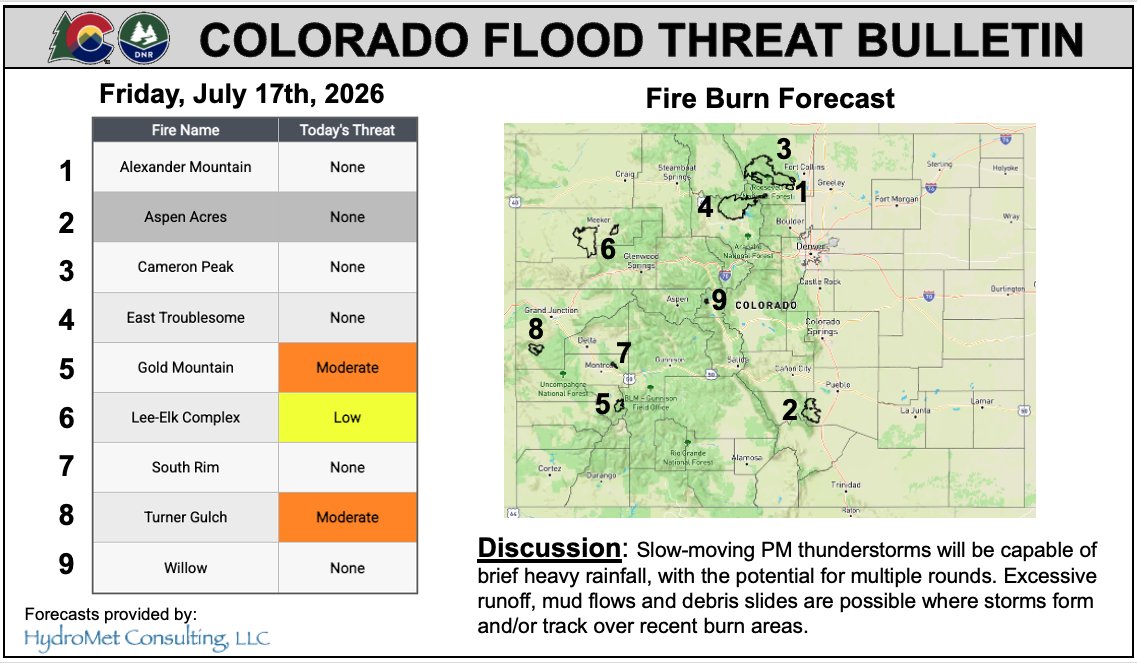
A July 17 Colorado Flood Threat Bulletin forecast rated the Gold Mountain and Turner Gulch burn areas Moderate for flooding as storms were expected across the region through the weekend.
The bulletin is a product of the Colorado Water Conservation Board and partners, not by itself a National Weather Service flood watch or warning. Its public forecast page shows county and fire-burn-area map layers but provides no clock-specific validity window or more detailed perimeter description for either area.
The Colorado Division of Homeland Security and Emergency Management amplified the forecast Friday evening. The National Weather Service’s Grand Junction office said showers and thunderstorms were expected through the weekend and that heavy rain could produce debris flows, particularly on recent burn scars. That forecast was time-stamped 4:24 p.m. MDT Friday and covered the Colorado River Headwaters forecast zone.
The reporting record did not confirm a flood watch, flash-flood warning, road closure or evacuation order specifically naming Gold Mountain or Turner Gulch for July 17-18. That does not establish that no local notice existed; relevant archived sheriff and weather-alert pages were not directly available for an independent check.
Residents in or below the burn areas should monitor National Weather Service and local emergency-management updates, avoid flooded or debris-affected areas, and follow evacuation or road-closure instructions. A Mesa County notice about the Turner Gulch and Wright Draw fires said the county was launching emergency watershed protection to reduce flooding and debris-flow risk and directed residents to the Mesa County Sheriff’s Office CrimeWatch page for evacuation and road-closure updates.