
Louisville zoning proposal would allow up to 1,021 homes in Centennial Valley
Louisville’s proposed Centennial Valley framework would add residential eligibility and parcel-specific development standards while leaving project-level infrastructure, environmental and traffic reviews for later hearings.
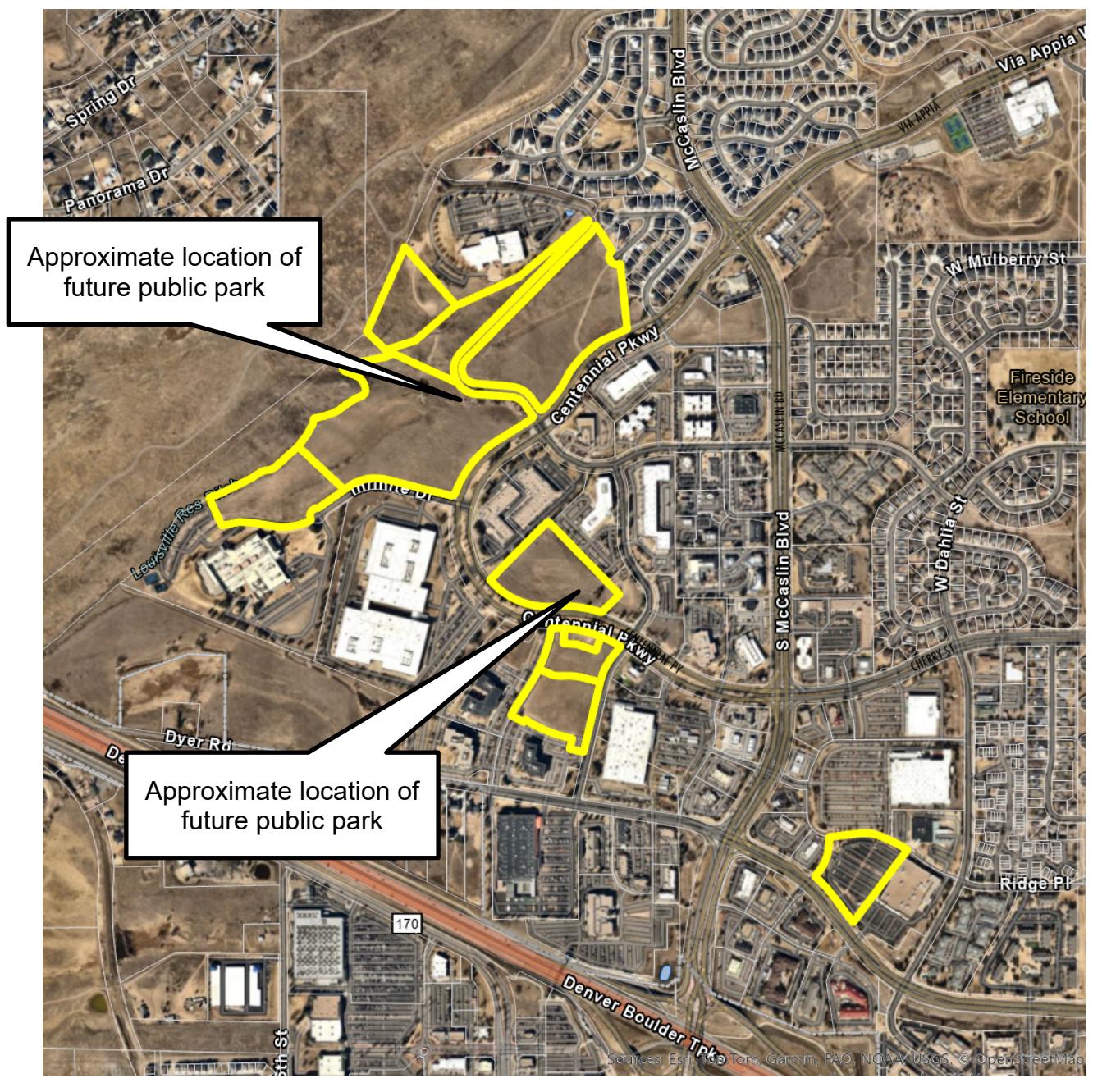
Louisville is considering a zoning framework that would allow residential development on about 73 acres in Centennial Valley, with maximum standards for 1,021 homes across seven parcels. The proposal would preserve commercial and office options in parts of the area, require two publicly accessible pocket parks and tie residential development on two parcels to a future trail connection.
The city’s development listing identifies the matter as the Centennial Valley General Development Plan amendment, Case No. ZON-0003-2026. As of Aug. 29, 2026, it listed a Public Parks and Landscaping Advisory Board hearing for Sept. 2 and an Open Space Advisory Board hearing for Sept. 9. Planning Commission and City Council hearing dates were listed as to be determined.
The city’s amendment narrative says the city and property owner are joint applicants. The proposal would add residential eligibility, maximum densities and building-height limits to properties currently limited to commercial uses. It would establish a land-use framework, not approve a specific development project, site plan or construction schedule.
The revised General Development Plan sets these maximum residential standards:
- Parcel B1: 30 homes on 5 acres, with up to six homes per acre; detached or attached single-family homes; 35-foot, two-story maximum.
- Parcel C: 145 homes on 24.18 acres, with up to six homes per acre; detached or attached single-family homes; 35-foot, two-story maximum.
- Parcel F1: 290 homes on 29 acres, with up to 10 homes per acre; detached, attached or multifamily housing; 40-foot, three-story maximum.
- Parcel G3: 191 homes on 6.38 acres, with up to 30 homes per acre; attached or multifamily housing; 45-foot, three-story maximum.
- Parcel L2A: 104 affordable multifamily homes on 2.81 acres, with up to 37 homes per acre; 45-foot, four-story maximum.
- Parcel L2B: 204 homes on 6.8 acres, with up to 30 homes per acre; attached or multifamily housing; 45-foot, three-story maximum.
- Parcel O2: 57 homes on 1.9 acres, with up to 30 homes per acre; attached or multifamily housing; 45-foot, three-story maximum.
The plan identifies L2A’s 104 units as affordable multifamily housing but says the parcel remains under city review and that its standards are included for reference only. The materials do not specify income limits, the length of affordability, tenure requirements, a fee-in-lieu option or another enforceable affordability mechanism.
The broader Centennial Valley plan identifies up to 2,245 residential units across 268.77 acres: 929 single-family units, 1,212 standard multifamily units and 104 affordable multifamily units. That total covers the broader plan, not homes newly authorized solely by this amendment. The plan also identifies 61.08 acres for retail uses and up to 515,000 square feet of building area, but does not quantify how much of that capacity would be newly authorized by the amendment.
If F1 is developed residentially, the proposal would require a publicly accessible pocket park of at least one-quarter acre. Residential development on G3 would require a publicly accessible park of at least one-half acre. Each park would be expected to include a multipurpose play lawn or hill, a shade structure and a playground with active-play elements for children of multiple age groups. If F1 and C are developed for residential use, the proposal also calls for a trail connection between Centennial Parkway and Davidson Mesa Open Space.
The Parks and Public Landscaping Advisory Board staff report says later development-plan or subdivision review would determine the parks’ locations, configurations, designs, ownership, maintenance responsibilities and infrastructure. Future Planned Unit Development applications would also address building locations, streets, parking, utilities, access, circulation, neighborhood compatibility, environmental conditions and other site-specific standards, with additional public hearings.
As of Aug. 29, the record did not include a confirmed Planning Commission or City Council hearing date. The Sept. 2 advisory-board materials are prospective records for a future meeting and do not show that the board has voted. The proposed advisory-board resolution is a recommendation to the Planning Commission and City Council, not final approval of the framework or any future homes, parks or trail.