
Louisville commenters seek more protected land, Dutch Creek buffer and Trail 18 reroute
Public commenters want Louisville to protect more land, add a 120-foot Dutch Creek buffer and remove or reroute Trail 18 as the city reviews draft parks and trail plans ahead of possible October adoption.
Published at
Louisville residents and Louisville Open Space Advocates are asking the city to expand protected-land designations, add a 120-foot Dutch Creek buffer, close and restore some undesignated trails, and remove or reroute a proposed trail near the Goodhue Ditch.
The requests are part of public comments on Louisville’s draft parks and open-space guidebook and long-range plan and Trail System Plan. The plans remain under review and have not been adopted.
Conservation requests
The draft parks and open-space plan proposes classifying 6% of Louisville’s open-space system as Preserve, 30% as Protected Lands, 40% as Visitor Lands and 19% as Other Lands. Cathern Smith, writing for Louisville Open Space Advocates, urged the city to use vegetation and wildlife mapping to identify substantially more land for Preserve status. Other comments from the group proposed that Preserve and Protected Lands together make up about half of the system, with roughly a quarter classified as Preserve.
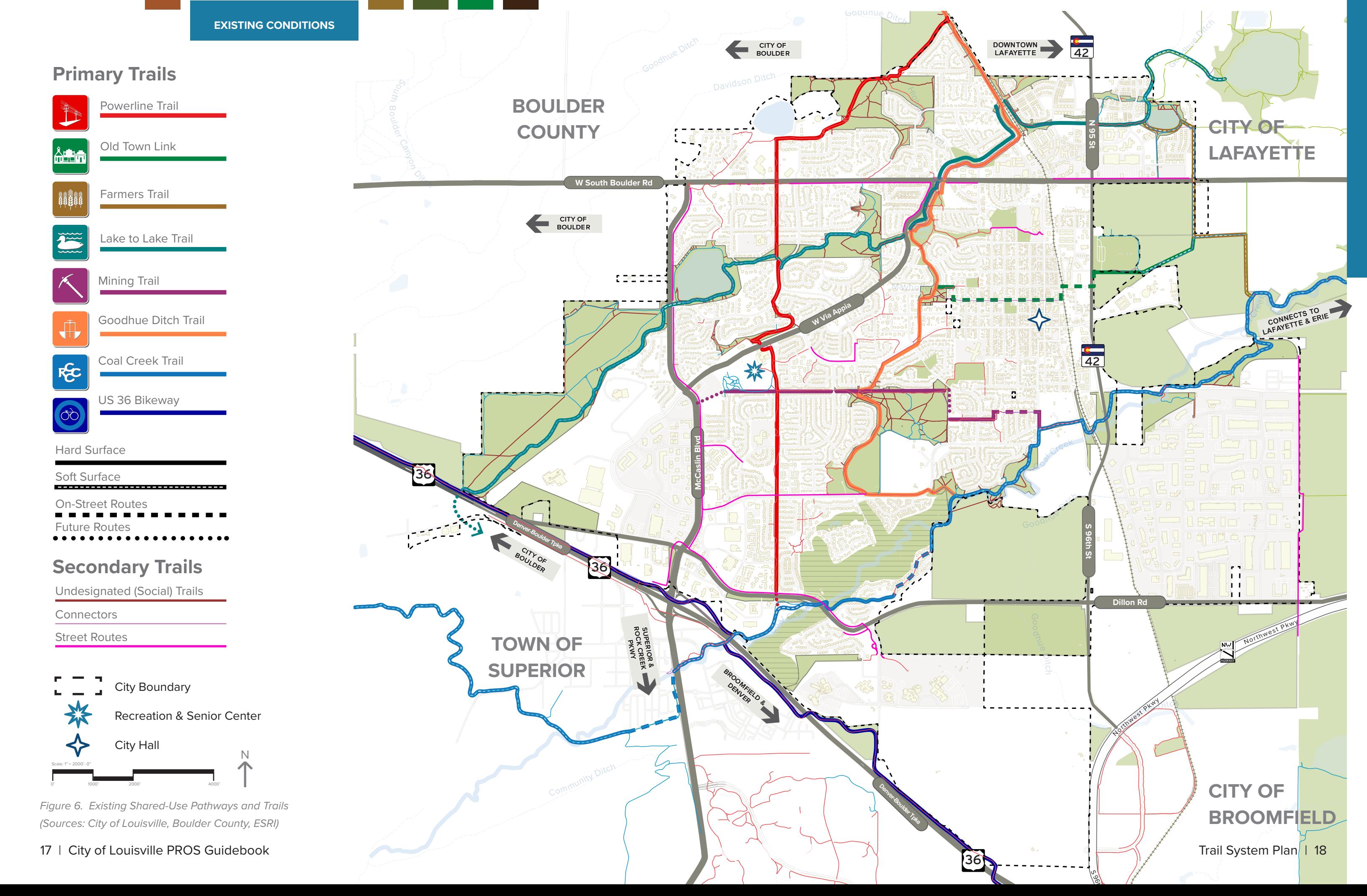
The group also asked the city to place the Dutch Creek riparian corridor and a 120-foot buffer in the Preserve classification. The request focuses on the Coal Creek floodplain near Coal Creek Trail. LOSA asked the city to close and restore undesignated trails near Dutch Creek and Hecla Lake. The Trail System Plan identified about 11 miles of such “social trails” and proposed closing and revegetating trails in Preserve areas while evaluating other paths case by case.
Trail 18 dispute
LOSA and resident Matt Jones asked the city to remove proposed Trail 18 from the Trail System Plan. The proposal would create an off-street connection between the Campus Drive extension near Red Tail Ridge and the Coal Creek Regional Trail along or near the Goodhue Ditch.
Commenters said the proposed alignment could affect riparian habitat, fragment wildlife corridors, interfere with agricultural operations and create safety problems at Dillon Road. They suggested studying a route along 96th Street that would use existing signalized crossings instead. Those are commenters’ assessments and recommendations, not established impacts or a city decision.
Plans remain under review
A Sept. 9 staff update lists Sept. 11 as the end of final public comment and review. It schedules City Council review of final versions through briefings or email on Sept. 21, followed by a final presentation and possible adoption of both plans on Oct. 6.
The draft plans are intended to guide future work plans, budgets, capital projects and grant applications. Any trail removal, rerouting, buffer designation or land-classification change would still require action through the plan-review and implementation processes.