
Erie drainage report proposes lowering Vista Ridge pond spillway
The proposed Pond B3 change would put modeled 100-year-storm water about 2.9 inches below a nearby lot line; the report also projects lower stormwater discharge.
Published at
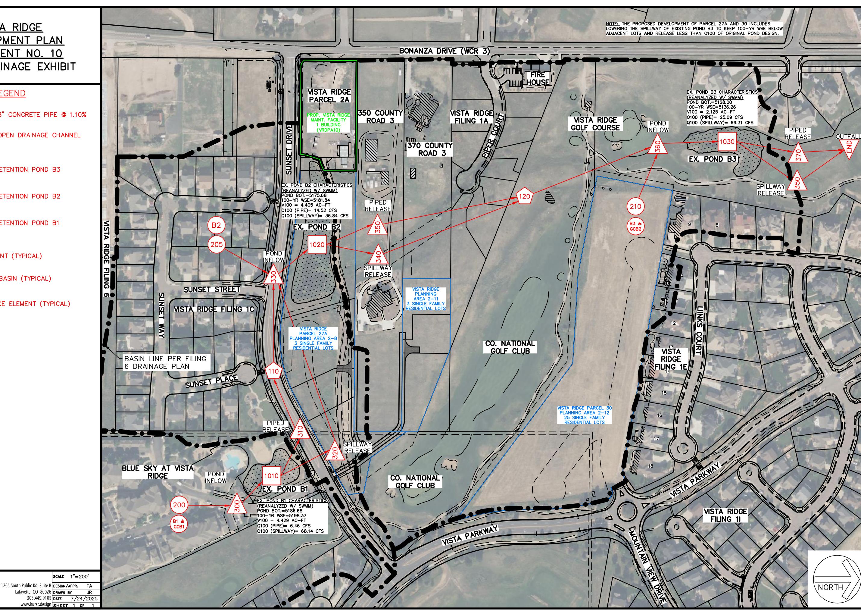
A drainage report for Erie’s Vista Ridge development proposes lowering Pond B3’s spillway. Its model estimates that water during a 100-year storm would remain about 2.9 inches below the lowest nearby rear lot line.
The [Phase I drainage report](https://erieco.api.civicclerk.com/v1/Meetings/GetAttachmentFile(fileId=3726) proposes lowering the spillway from an elevation of 5,136.40 feet to 5,135.75 feet. It calculates a 100-year water-surface elevation of 5,136.26 feet, compared with 5,136.50 feet at the lowest rear lot line cited for nearby Lot 16. The report says the change is intended to protect adjacent residential lots.
The report also models a total 100-year release from Pond B3 of 94.4 cubic feet per second, compared with an original reported rate of 120.4 cubic feet per second. These are calculations for the proposed design, not measured storm flows.
The report also evaluates residential land-use changes under Amendment No. 8 because runoff from those changes and the proposed facility would enter the same drainage system. The spillway change remains a proposal in the report; the calculations are model results, not a guarantee of performance in every storm.